More Than Just Marketing Images
Traverse City is a dynamic area that often has several projects underway at a given time. Presenting a new development venture requires more than just architectural plans; it demands persuasive and accurate visualizations. Our development renderings for Peninsula Place showcased the design’s beauty and functionality as well as its impact on the surrounding environment. These renderings for real estate went beyond mere aesthetics and were grounded in precise 3D models that showed the development from multiple perspectives.
Our Detailed Process in creating renderings for real estate
Our approach to Peninsula Place underscored our dedication to accuracy in renderings for city planning. The following steps outline our process:
- 3D Base Modeling: We began by meticulously mapping the area, constructing a detailed 3D model of existing conditions. This model served as the foundation for all subsequent work, ensuring that every aspect of the current environment was accurately represented.
- Photographic Exploration: Multiple photographs were taken from various angles and perspectives to show the environment from all viewpoints. This step was crucial in understanding how the new development would integrate with its surroundings.
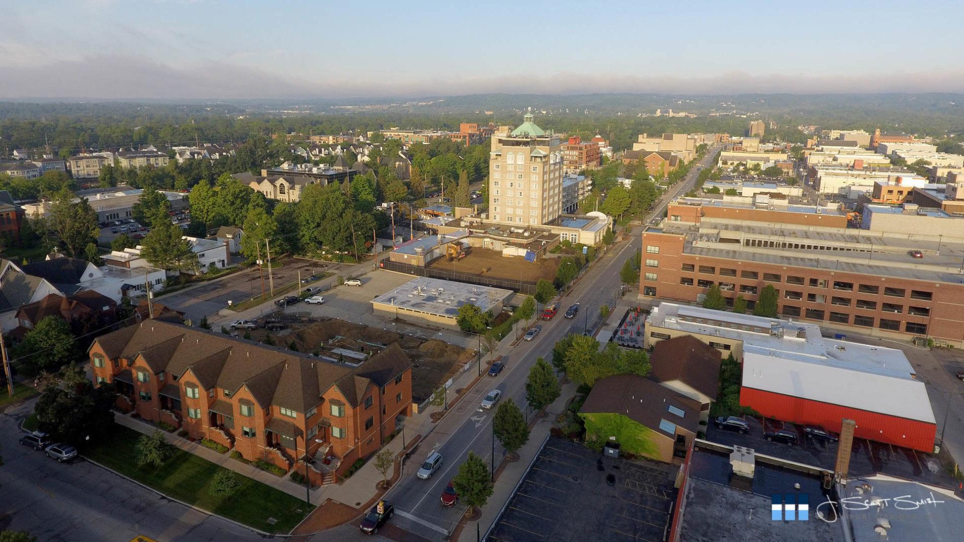
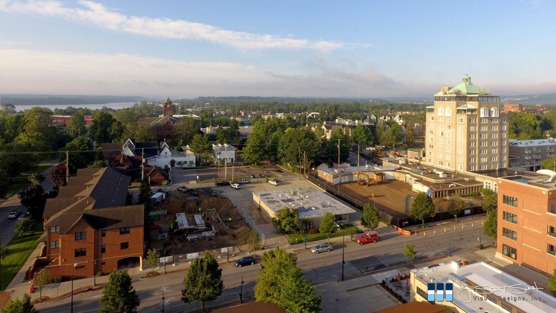
- Incorporating Ongoing Developments: Our 3D model included the subject property as well as the completion of two adjacent ongoing projects and road work construction. This integration provided a comprehensive view of the future landscape, allowing stakeholders to see how different elements would coexist.
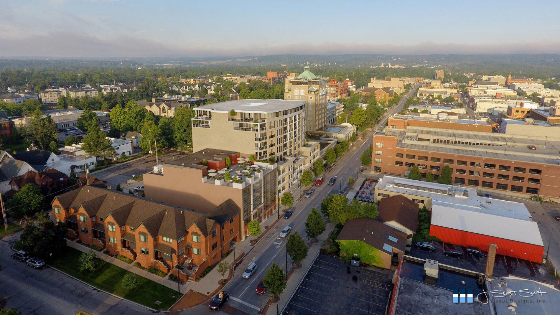
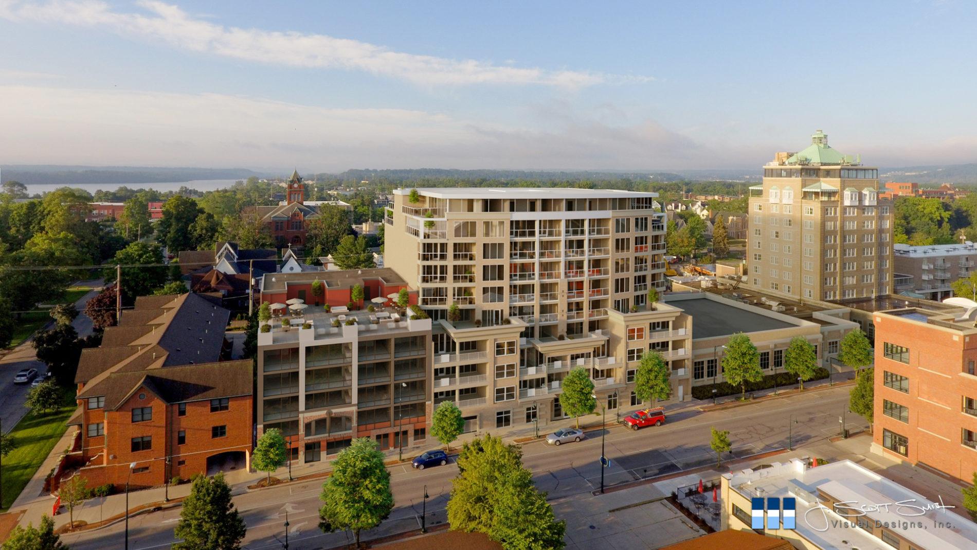
- Final Composites: Using a combination of 3ds Max, Octane Render, and a number of specialized plugins, we created complete and accurate visualizations of the proposed future conditions. With these in hand, we then created composite renderings using Photoshop for architectural renderings to show the proposed Peninsula Place mixed-use retail and condos, as well as the adjacent projects and infrastructure enhancements, offering a clear vision of the future development.
- Street-level Perspectives: The Peninsula Place project gained local notoriety due to the developer seeking an exemption from the city’s building height code. We used street-level points of view in our development renderings to show the designer’s unique solution of stepping back the upper floors to make the building seem less imposing. This design helped hide the height from the average pedestrian’s perspective and ensured that the development blended seamlessly into the cityscape without overpowering the surrounding environment.
Below, you’ll find a couple of the before and after images created for our client.


USES FOR CITY PLANNING
Our renderings for city planning are essential tools in the urban development process. They helped illustrate how the building would fit into the existing cityscape and its potential positive impact on the community. For instance, the proposed mixed-use retail and condos at Peninsula Place were designed to bring both commercial and residential benefits to the area, fostering a vibrant community hub. Our renderings for real estate and city planning made it possible to visualize these benefits clearly, showing how the new development would enhance the local environment.
Our photorealistic visuals highlighted the benefits of using Photoshop for architectural renderings to garner public support and facilitate informed decision-making. By presenting a clear and accurate picture of the future development, stakeholders could make more informed choices, balancing growth with community needs.
Why Choose Development renderings?
In a world where every development can spark a debate, having accurate, unbiased visualizations is no longer a luxury – it is crucial. Whether for marketing, presentations, or regulatory approvals, our 3D visualizations help bridge the gap between architects, developers, and stakeholders. Here are several reasons why our renderings stand out:
- Accuracy: Our renderings for real estate are based on precise 3D models, ensuring that every detail is accurately represented. Getting this right is crucial for demonstrating the influence of a development from any perspective.
- Real-World Impact: By integrating ongoing developments and infrastructure projects, our renderings provide a comprehensive view of the future landscape. This approach helps all involved in the process understand how different elements will coexist and interact.
- Photorealistic Visuals: We create visuals that are not only accurate but also visually stunning. These photorealistic images help stakeholders and the public alike envision the future development as if it were already built.
- Enhanced Communication: Our 3D visualizations facilitate better communication between architects, developers, and stakeholders. By providing a clear and accurate picture of the future development, all parties can engage in more productive discussions and make informed decisions.


Partner with us to bring clarity and precision to your next project. Our expertise in renderings for real estate and renderings for city planning will help you present your development projects with accuracy and impact. Explore how our use of 3D software as well as Photoshop for architectural renderings can enhance your city planning and real estate endeavors. Together we can create visualizations that not only look beautiful but also communicate the true potential of your development projects.
17-041

0 Comments