The Power of 3D Rendering for Real Estate
City planning is undergoing a transformation thanks to advancements in technology including interactive 3D models and drone photography. This is a significant addition to the 3D rendering for real estate we also do. These services allow developers and stakeholders the capacity to visualize properties in a detailed and interactive manner. This technology enhances the ability to present accurate and appealing visuals of all sorts to potential investors and clients, providing a more immersive experience compared to traditional 2D plans and static images.
Capturing Historic Landmarks and New Constructions
In the window below, you can interact with a 3D model of an intersection in downtown Traverse City. This is a prime example of the capabilities of modern technology in city planning. This project involved capturing both historic landmarks and new construction to provide the most up-to-date representation of the site. Using drone photographs and LiDAR scanning technology, we are able to document every detail of the area, from the architectural features of historic buildings to the latest developments in urban infrastructure.
Advanced Techniques: Drones, LiDAR, and 3D Modeling
Drones equipped with high-resolution cameras captured aerial images and data from multiple angles, while LiDAR technology provided precise measurements by using millions of laser pulses to map the environment. This combination of aerial and terrestrial data collection ensured that the 3D model was both comprehensive and accurate. Our expertise in remote sensing for city planning and 3D modeling allowed us to integrate this data seamlessly.
Real-World Applications
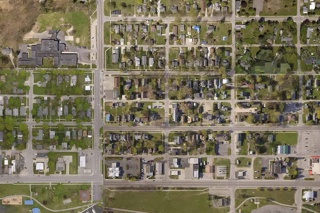
One of the most significant advantages of using interactive 3D models in city planning is the ability to establish current real-world conditions. Traditional tools can be outdated in several years, but our method provides a real-time snapshot of the city. This is crucial for accurate planning and development analysis. The image below is an example of an orthophoto – not a photograph, but an image generated from a 3D model created from hundreds of aerial observations.
Interactive 3D models allow planners to place proposed buildings within the current urban context, facilitating a more thorough analysis of how new developments will impact the existing environment. This is particularly useful for evaluating factors such as sightlines, shadows, and the overall aesthetic impact of new construction.

Versatility in Use: From City Planning to Tourism
The applications of 3D models extend beyond city planning and real estate. They are valuable tools for marketing and tourism, offering a virtual tour experience that can attract visitors and investors alike. For example, potential tourists can explore Traverse City’s landmarks and attractions remotely, enhancing their decision to visit. Similarly, developers can showcase future projects to stakeholders with a level of detail and interactivity that static images or blueprints cannot provide.
Conclusion: A New Era in Urban Development
The integration of 3D modeling and drone technology in city planning represents a significant leap forward in how we visualize and interact with urban spaces. By leveraging tools like drone photography, LiDAR scanning, and advanced 3D rendering, city planners and developers can create highly detailed, interactive models that are crucial for informed decision-making. Whether for planning, development, marketing, or tourism, the utility and capabilities of these technologies are enhancing our ability to plan and develop urban areas and offering new ways to engage with and understand our cities. As we continue to explore and refine these tools, the possibilities for their application in real estate and beyond are limitless.
#17-049, 18-092, 19-033


0 Comments