Elevating Perspectives with Aerial View Renderings
Introduction
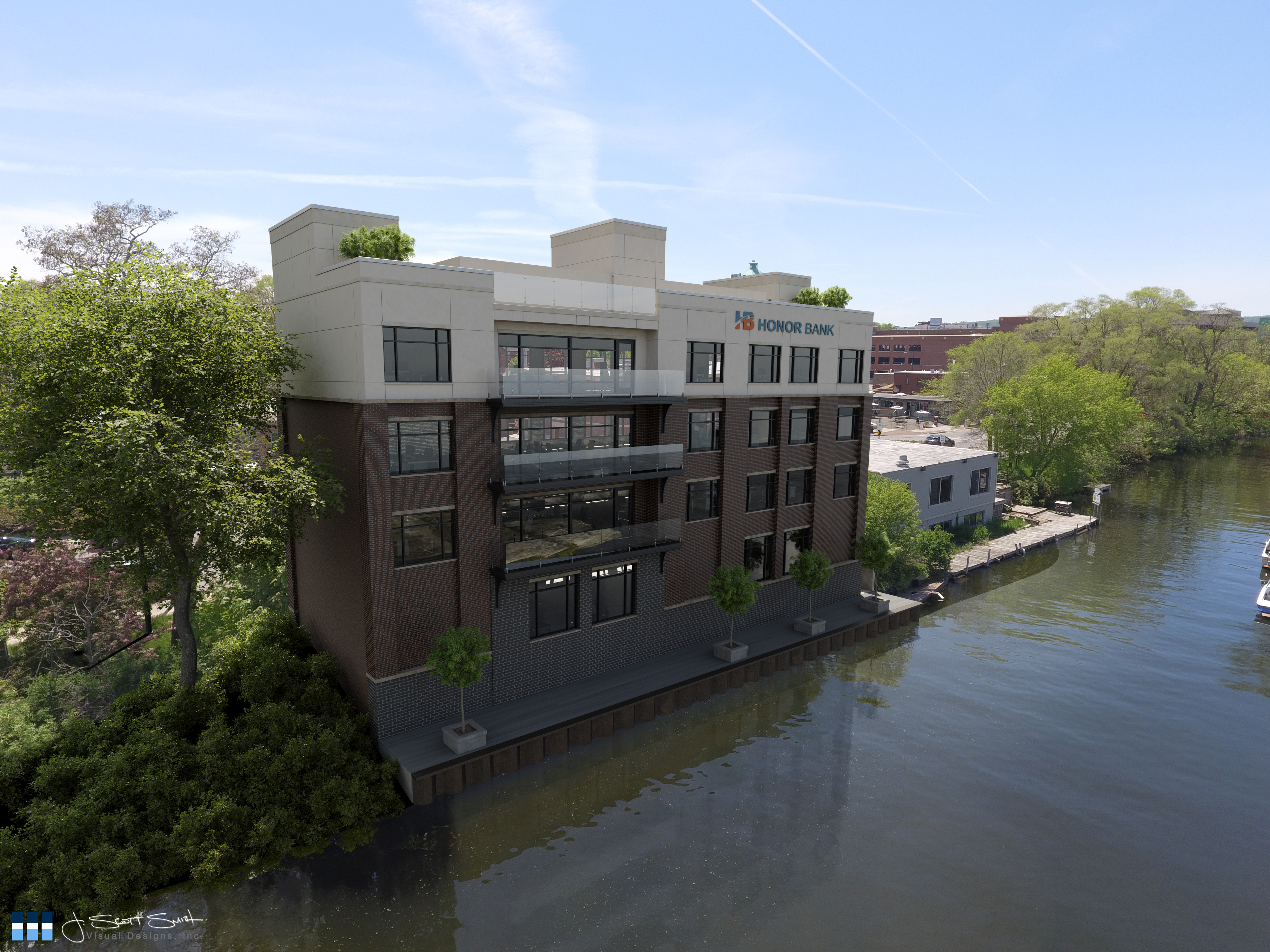
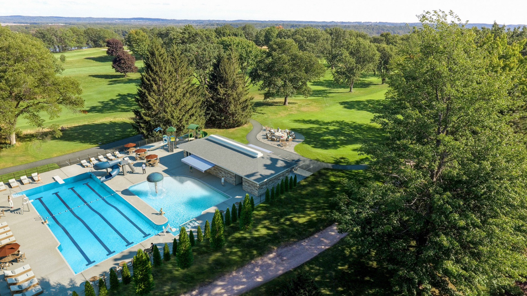
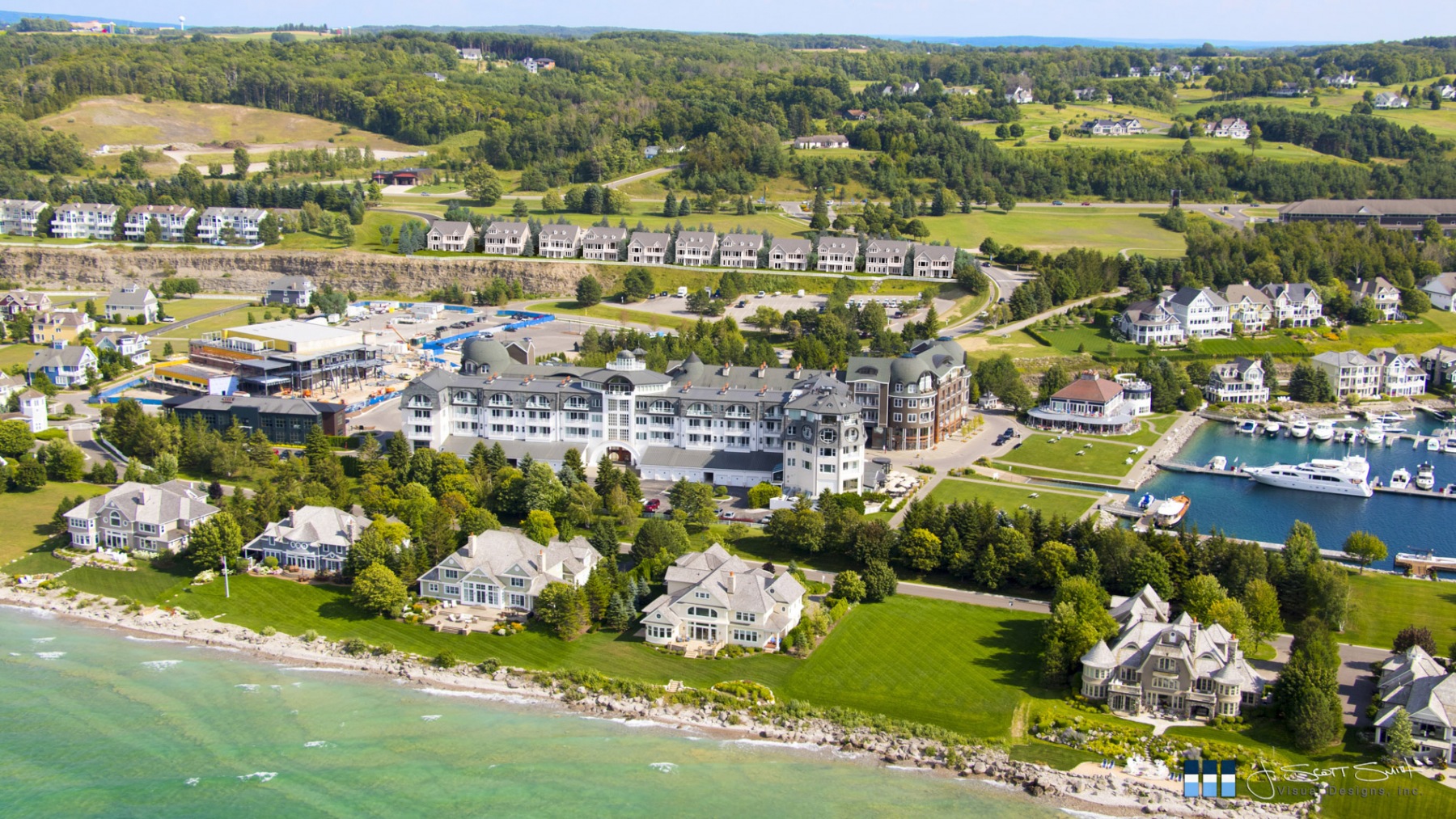
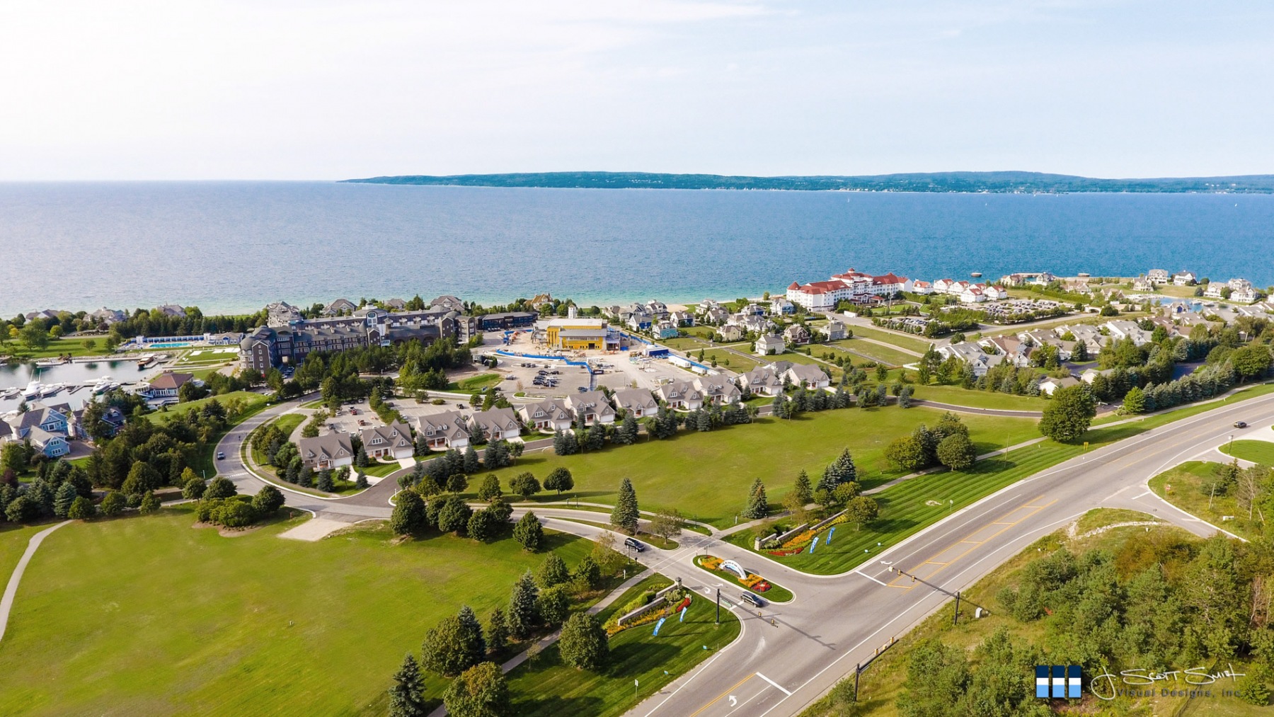
For architects and developers, aerial view renderings are more than a novelty perspective – they’re an invaluable tool for conveying emotion and dramatically bringing visions to life. A birds eye view rendering enables you to inspire, captivate, and persuade your clients on an entirely new level.
Whether you are far away or searching for “architectural rendering services near me”, J. Scott Smith Visual Designs is ready to help you with the aerial view renderings you need. By leveraging decades of visualization expertise and the latest 3D modeling and photorealistic rendering technologies, we transform your designs into striking visuals that connect with your prospects like nothing else.
Architectural Rendering Services
Founded over two decades ago, J. Scott Smith Visual Designs has grown into a creative team that is expert at 3D modeling and photorealistic rendering, and more importantly at communicating your vision to the public.
As highlighted by long-time client Kevin E., our architectural rendering services have directly helped him and his clients to achieve their goals:
Scott is truly gifted in being able to take a project from a concept and render it to look more realistic than any photo ever would. His abilities in rendering far exceed anyone else we have worked with. His 3D presentations make any job look professional and go a long way in trying to sell a project. Any Real Estate or Development needs, Scott is a must have on your team.
This is also reinforced by architect John W.:
Scott is a consummate professional – creative, passionate, articulate and efficient. We have used Scott on several projects and the results have been above and beyond expectations. I will use Scott’s services again when the need arises. If you need great project visualizations hire Scott and you will not be disappointed.


Bringing Your Vision to Life: On-Site and Remote Aerial Capture
In our commitment to providing unparalleled architectural rendering services, we go beyond the confines of our studio to bring your project to life. If you’re within striking distance, our team is equipped to come to you, capturing your exact surroundings with our state-of-the-art drone technology. This hands-on approach allows us to gather real-world context, ensuring that our aerial view renderings are as accurate and immersive as possible.
For clients further afield, worry not. We coordinate with licensed drone pilots in your area to capture the necessary visuals. This collaboration ensures that, regardless of your location, we can secure the high-quality imagery needed to accurately represent your project’s environment.
In cases where weather, FAA regulations, or other constraints make drone photography impractical, our other birds eye view rendering options remain. We can model the surroundings based on available data and imagery, ensuring that your aerial view renderings are still realistic and precise. This flexibility in our approach guarantees that no matter the circumstances, we can deliver renderings that bring your vision to the forefront.
From Plans to Plan Renderings
Architectural visions often remain obscured in the complexity of blueprints and specifications. We like to think of ourselves as visual storytellers, here to translate the technical into the familiar through images.
We understand the significant challenge that developers and architects face in conveying their vision to the public.
“It’s too tall.” “It’s out of character.” “It won’t fit in.”
We understand, and we want to help.
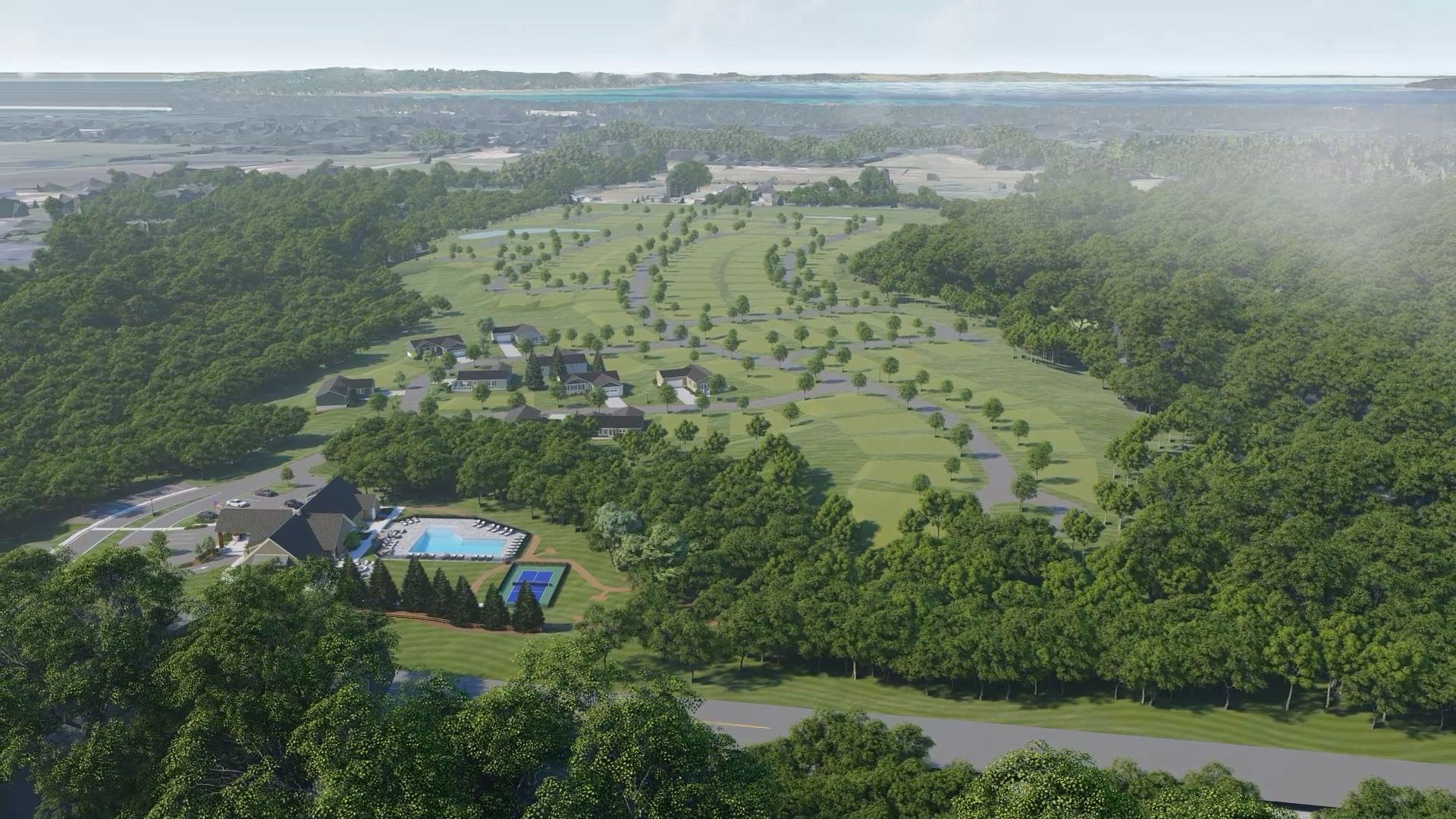
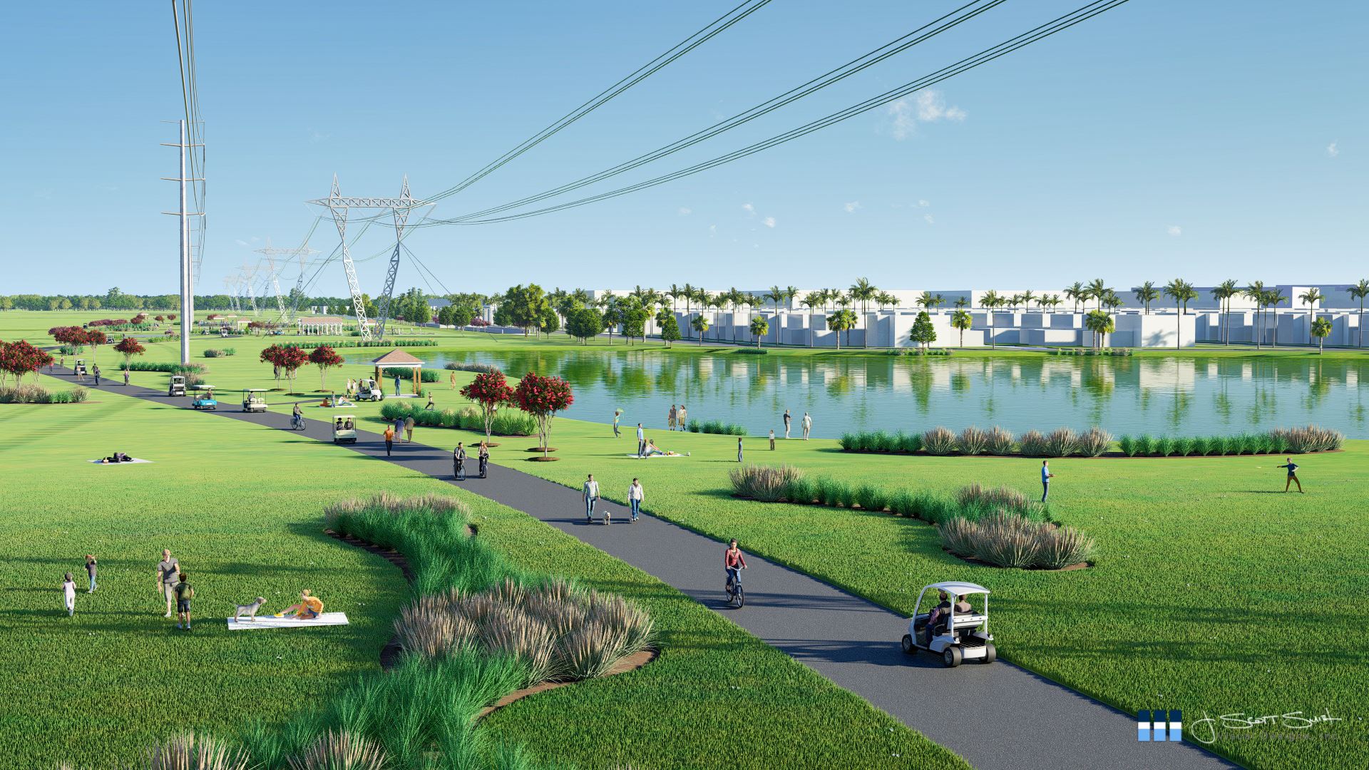
Plans and elevations won’t cut it. Aerial view renderings transform your designs into visual stories that are easily understood.


Renderings that show a building or development in context are essential to helping the public understand the proposed project. Perhaps a pedestrian won’t even see the feature that has them troubled. Or maybe the building only looks foreboding because they don’t realize how it relates to adjacent buildings. Or maybe the development being proposed is going to be screened off by vegetation so it’s unlikely that people will even know it’s there.
These are some of the reasons that we recommend composite imagery like plan renderings or aerial view renderings – products that give your audience a clear understanding of your proposed development.

The Unseen Vision: From Complex Concepts to Compelling Stories
Every great design begins as a complex concept, a blend of creativity and technicality that can be daunting to the uninitiated. It’s in these intricate details that the true essence of a project lies, waiting to be discovered and appreciated. Our aerial view renderings are crafted to illuminate these nuances, translating technical jargon into a language of visual elegance and clarity.


Bridging the Gap: Aerial View Renderings as a Communicative Tool
The journey from blueprint to realization is often fraught with communication barriers. Our renderings serve as a bridge, connecting the architect’s vision with the public’s understanding. A detailed birds eye view rendering ensures that every element of your design is not just seen, but felt and comprehended, making the complex simple and the abstract tangible.
The Emotional Catalyst: Evoking Connection and Desire
More than mere representations, our aerial renderings are emotional catalysts. They are designed to evoke a sense of connection, to stir desire and anticipation. It’s about showcasing not just structures, but potential lifestyles, communities, and futures. Each rendering is an invitation to step into a world yet to be built, to experience the possibilities that lie within each design.


The Culmination: Where Visions Take Flight
Our work is the culmination of your architectural journey, the point where visions take flight. Each project we undertake is a testament to the power of visual storytelling in architecture – a chronicle of turning visionary ideas into compelling narratives that resonate with audiences far and wide.
Conclusion: Your Vision, Our Mission
The right partner in architectural rendering can feel like a local ally, always within reach. This is why many searching for “architectural rendering services near me” find a solution in J. Scott Smith Visual Designs. Whether you are nearby, or across the world, we’re here to help.
At J. Scott Smith Visual Designs, we don’t just render images; we render dreams into visual narratives. We are committed to transforming your architectural visions into aerial view renderings that captivate, communicate, and connect. Partner with us, and together, let’s bring the story of your design to life, elevating perspectives and expectations alike.
